GeoStratum
Overview
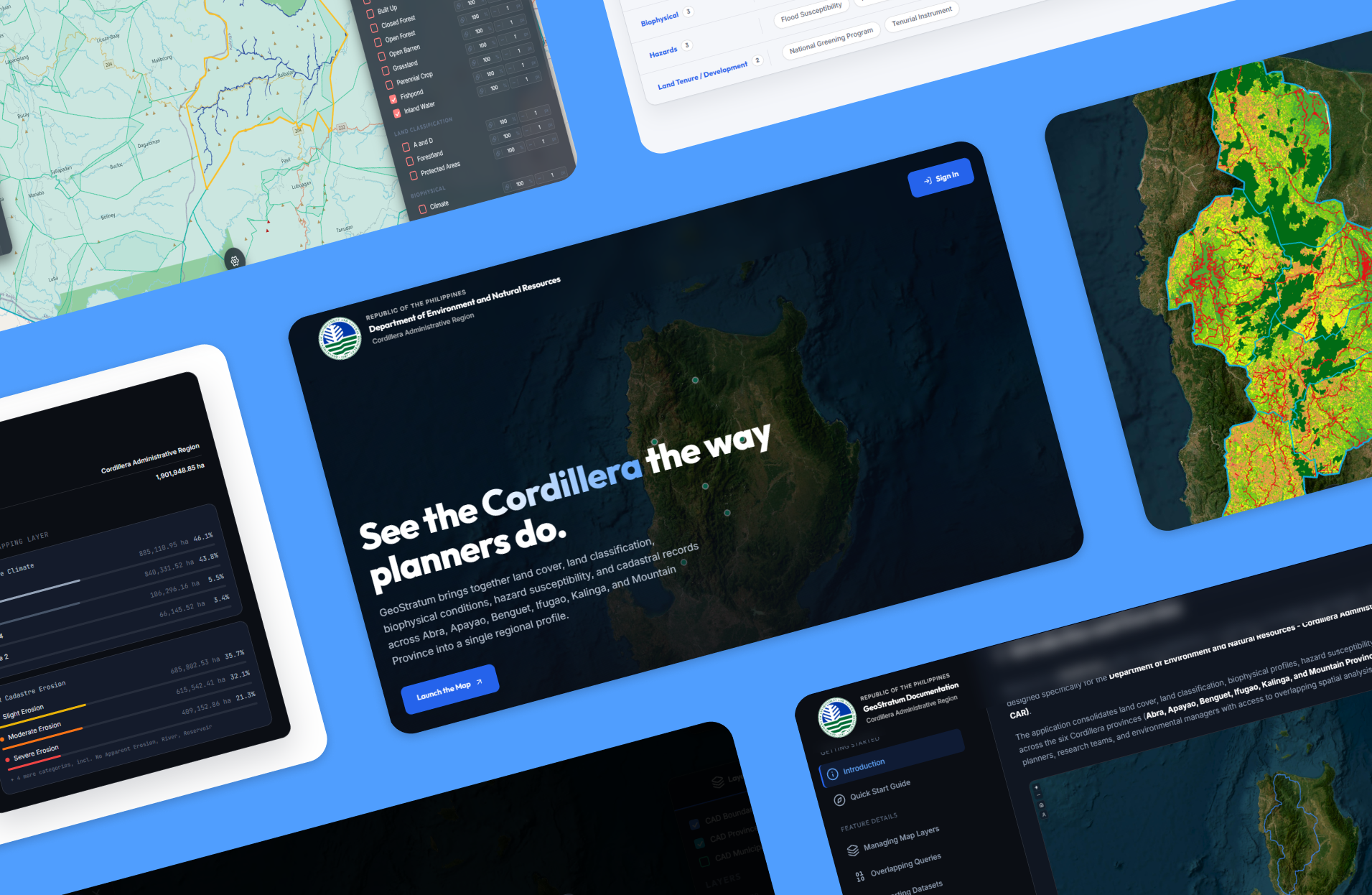
GeoStratum is an interactive web GIS profile built in collaboration with Saint Louis University for the Department of Environment and Natural Resources (DENR CAR). It brings together land cover, land classification, biophysical conditions, hazard susceptibility, and cadastral records across the region into a single unified map for regional planners.
VIEW LIVE SITEServices
- Web Development
- GIS Development
- UI/UX Design
Core Features
- Interactive Map
- Spatial Analysis
- Layer Toggling
Tech Stack
- Leaflet.js
- JavaScript
- HTML/CSS
Completed
- Internship
- July 2026
Spatial Interaction
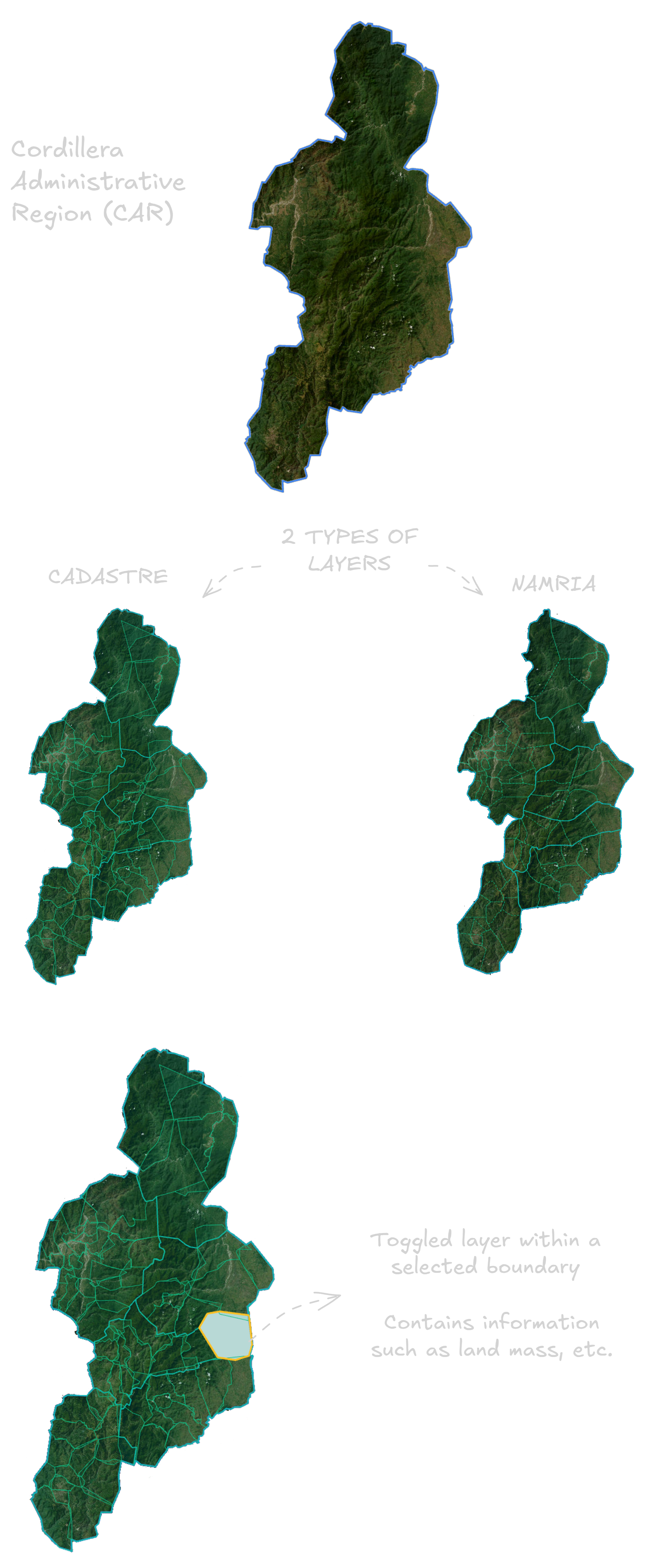
Dual-source Mapping
The platform harmonizes national NAMRIA and local Cadastre datasets into a unified coordinate system. Planners can isolate specific sub-regions and toggle environmental layers within that active boundary to instantly compute localized metrics eliminating region-wide visual clutter.
Spatial Analysis
Layer Computations and Custom Imports
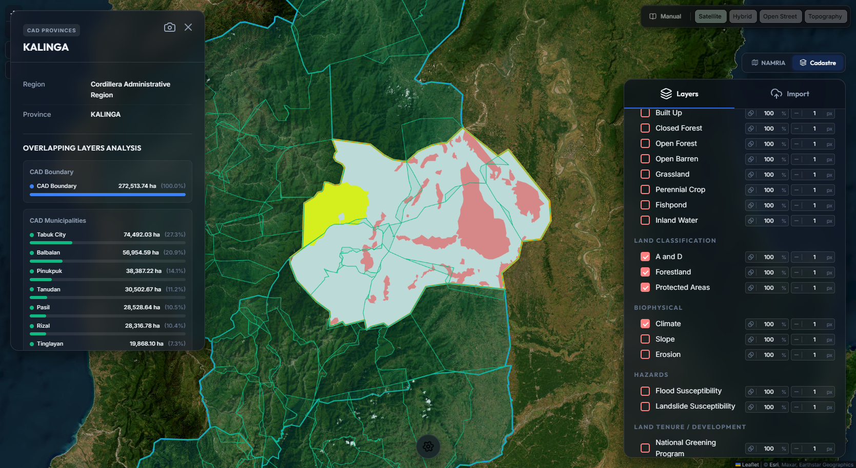
Selecting a specific provincial or municipal boundary visually
isolates the region and triggers a localized spatial analysis. The
interface dynamically evaluates the selection to compute exact
geometric intersections for all active environmental layers
contained within that targeted zone.
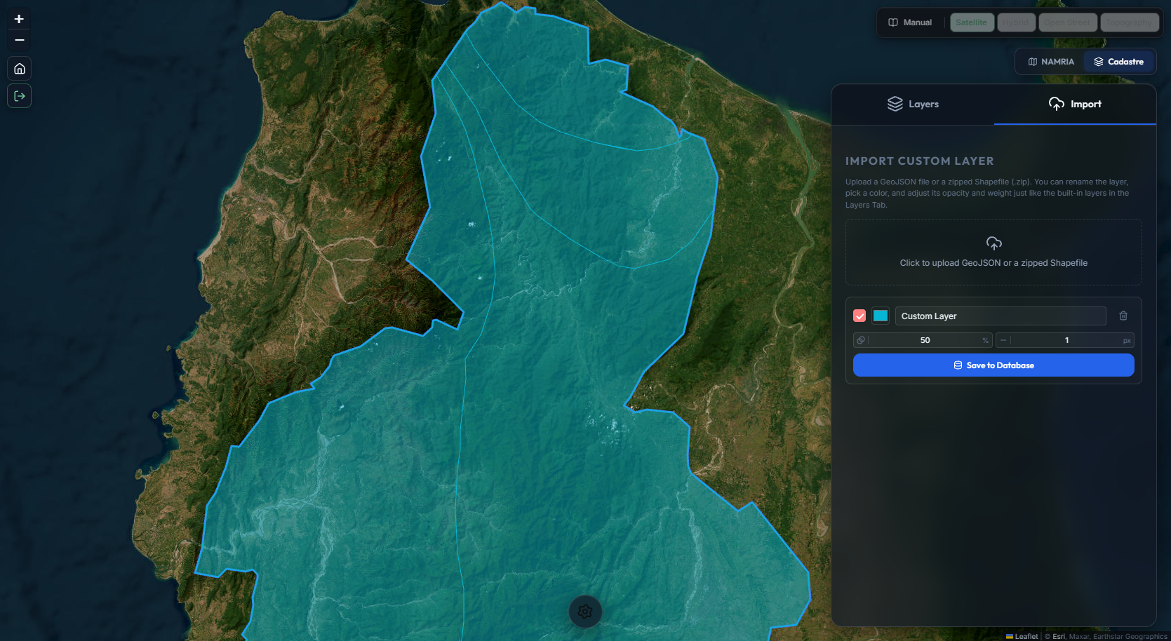
Planners can directly upload custom GeoJSON or zipped Shapefiles
to overlay their own external spatial data. The platform instantly
parses and renders these files as interactive map layers, granting
users full control over visual properties like opacity, color, and
line weight directly within the browser.
Technical Documentation
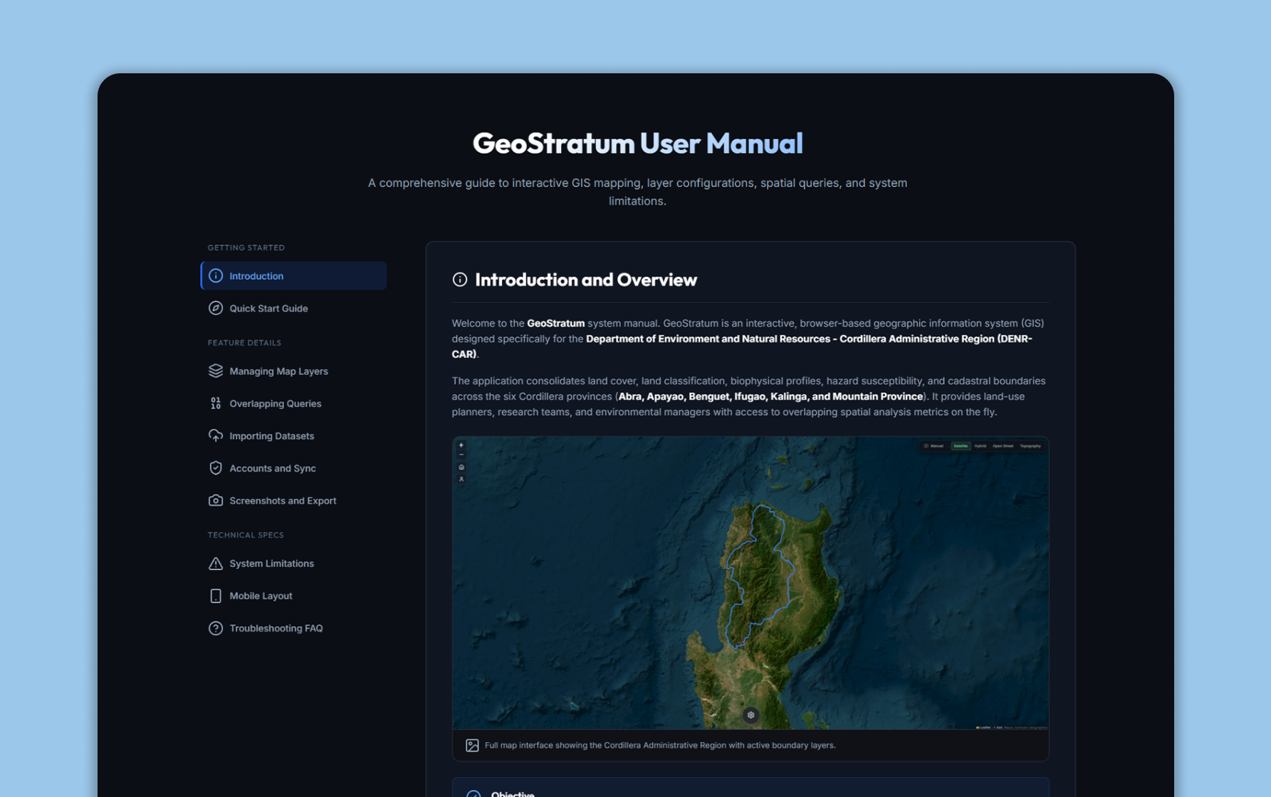
System Manual
The platform features a comprehensive, browser-based user manual detailing layer management, spatial queries, custom data imports, and system limitations.